VFR · Lesson 51 · 9 min · ACS PA.VI · ACS PA.V
VOR, GPS and Area Navigation
Reviewed by a panel of three CFIs + AI review
Summary
The VOR gives heading-independent left/right and TO/FROM guidance along a selected radial; GPS-based RNAV gives precise position and direct waypoint-to-waypoint navigation, with traditional skills kept as backup.
Also watch
Quick check ▾
One question on what you just read.
Question 1 of 1
VOR navigation · Topic mastery: Not started
Exit0 of 1 answered
A VOR transmits radials measured in what reference?
Why this matters in flight
Electronic navigation lets you fly precisely beyond sight of landmarks. Knowing how a VOR radial works, and how GPS-based RNAV differs, lets you use these aids correctly and recognize when to fall back on pilotage and dead reckoning.
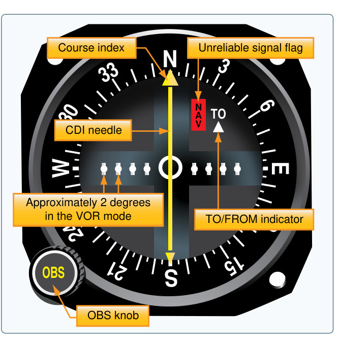
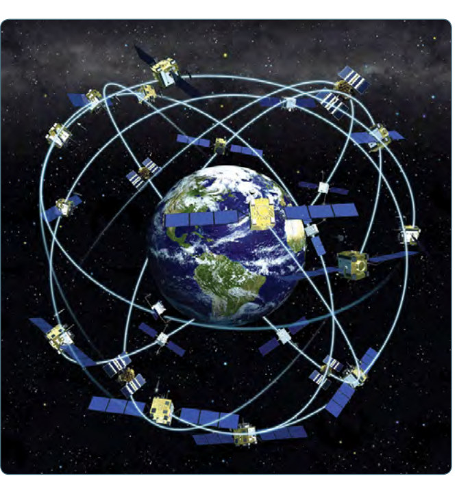
The VOR broadcasts 360 radials, each a magnetic bearing outward from the station. You select a course with the omni-bearing selector; the course deviation indicator then shows whether you are left or right of that course, and a TO/FROM flag tells you whether the course leads to or away from the station. A crucial point is that a VOR indication does not depend on your heading — it reflects only your position relative to the selected radial. GPS works differently: a satellite-based receiver computes your precise position, groundspeed, and course anywhere, and it enables area navigation (RNAV), which lets you fly directly between arbitrary waypoints instead of station to station. GPS depends on receiving several satellites and uses integrity monitoring such as RAIM, so a prudent pilot keeps traditional navigation skills sharp in case of an outage. Distance measuring equipment (DME) complements these aids by reading out the nautical-mile distance to a DME-equipped station like a VOR/DME or VORTAC. DME measures slant range — the straight-line distance to the station — rather than horizontal distance, so directly overhead a station it shows roughly your height above it, and many units also display groundspeed and time to the station.
Key terms
- Radial
- A magnetic bearing outward from a VOR station.
- Course deviation indicator
- The instrument showing left/right displacement from a selected course.
- RNAV
- Area navigation allowing direct flight between defined waypoints.
- DME
- Distance measuring equipment — shows slant-range distance in nautical miles to a DME station.
- Slant range
- The straight-line distance from the aircraft to a station, which DME measures (not horizontal distance).
Sources & references · 3 · 3 linked
Every claim traces to a source — paraphrased knowledge elements pointing at the governing FAA publication. Items marked verified have been checked against the retrieved source text; the rest are pending verification. Where the exact page or regulation has been located in a retrieved document, the source links straight to it.
- AIM 1-1 / PHAK Ch. 16 — Aeronautical Information Manual verifiedAIM 1-1 (p. 55)
- AIM 1-1 / PHAK Ch. 16 — Aeronautical Information Manual verifiedAIM 1-1 (p. 55)
- PHAK Ch. 16 — Pilot’s Handbook of Aeronautical Knowledge verifiedPHAK Ch. 16 (p. 388)
Community
Ask for more detail or suggest additions to make this lesson better. Community input — not authoritative and not CFI-reviewed.
Sign in or create a free account to join the conversation.
No comments yet — be the first to help improve this lesson.