VFR · Lesson 41 · 8 min · ACS PA.I.C
Air Masses, Fronts and Clouds
Reviewed by a panel of three CFIs + AI review
Summary
Cold fronts are fast and stormy with clearing behind; warm fronts are broad, cloudy, and wet. Cumuliform clouds signal instability, stratiform clouds signal stability, and the ceiling is the lowest broken or overcast layer.
Also watch
Quick check ▾
One question on what you just read.
Question 1 of 1
Air masses and fronts · Topic mastery: Not started
Exit0 of 1 answered
What weather is typically associated with the passage of a fast-moving cold front?
Why this matters in flight
Most significant weather changes happen at fronts. Recognizing the front you are approaching, and reading the clouds that come with it, lets you anticipate the visibility, wind shift, and precipitation you will actually encounter.
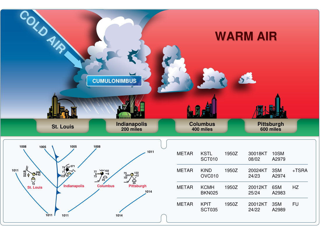
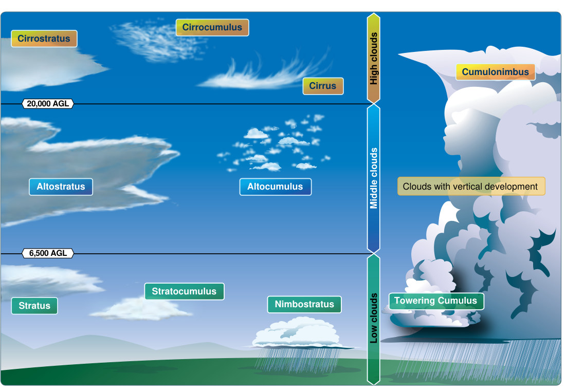
An air mass adopts the temperature and moisture of the region where it forms, and a front is the boundary where two air masses meet. A cold front, where cold air shoves warm air aside, is usually fast and narrow: expect a compact line of showers or thunderstorms and rapid clearing with cooler, drier air behind it. A warm front, where warm air rides up over cool air, is broad and gentle: expect widespread low clouds, steady precipitation, and lowering ceilings well ahead of it. A stationary front barely moves, and an occluded front forms when a cold front catches up to a warm front. The clouds tell the story too. Cumuliform (heaped) clouds mean rising, unstable air with possible turbulence and showers; stratiform (layered) clouds mean stable air and smoother flying. The lowest broken or overcast layer defines the ceiling, which is often what decides whether a VFR flight is legal and safe.
Key terms
- Air mass
- A large body of air with fairly uniform temperature and moisture.
- Front
- The boundary between two air masses of different characteristics.
- Ceiling
- The height AGL of the lowest broken or overcast cloud layer.
Sources & references · 2 · 2 linked
Every claim traces to a source — paraphrased knowledge elements pointing at the governing FAA publication. Items marked verified have been checked against the retrieved source text; the rest are pending verification. Where the exact page or regulation has been located in a retrieved document, the source links straight to it.
- PHAK Ch. 12 / Aviation Weather Handbook FAA-H-8083-28 — Pilot’s Handbook of Aeronautical Knowledge verifiedPHAK Ch. 12 (p. 285)
- Aviation Weather Handbook FAA-H-8083-28 / PHAK Ch. 12 — Aviation Weather Handbook verifiedWeather Handbook (document)
Community
Ask for more detail or suggest additions to make this lesson better. Community input — not authoritative and not CFI-reviewed.
Sign in or create a free account to join the conversation.
No comments yet — be the first to help improve this lesson.